
joshuafuller/ATAK-Maps
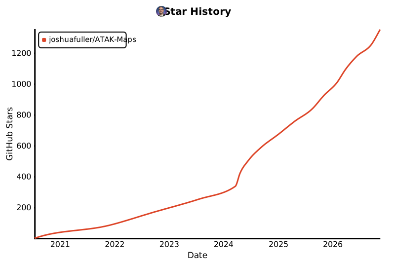
joshuafuller/ATAK-Maps has 1,350 GitHub stars and 171 forks. GitHot measured +1 stars in 24 hours and +11 in 7 days. Last checked 2026-11-12 00:01 UTC. Last push 2026-11-02.
Map sources for ATAK: satellite, topo, street, nautical, aeronautical and overlay maps, each tested the way ATAK loads tiles.
Measured star growth
- in 24h
- +1
- in 7 days
- +11
- in 15 days
- Update delayed
- in 1 month
- Update delayed
Net star changes over overlapping periods, not daily totals. Missing measurements are left blank. Stars measure attention, not software quality.
README.md
Original
Satellite, topo, street, nautical and overlay maps for ATAK.
Each one is tested the way ATAK loads tiles.





Open the map explorer →
Install maps
Problems? See Install & fix. |
Add or fix a map
ATAK 5.1 or later. Not affiliated with TAK.GOV. |
Maps
| Type | Maps |
|---|---|
| Satellite | Bing Hybrid · Bing Satellite · Esri Clarity · Google Hybrid · Google Hybrid No POI · Google Satellite · NAIP Imagery · PL Ortho · USGS Imagery · USGS Imagery Topo |
| Topographic | CA Toporama · DE Basemap Elevation · DE Basemap Hillshade · Esri Topo · Esri USA Topo · Google Relief · Google Terrain · OpenTopoMap · UK OS Outdoor · USGS Relief · USGS Topo |
| Street | Bing Road · CA Base Map · DE Basemap Color · DE Basemap Gray · Esri NatGeo · Google Road · Google Road Alt · Google Road No POI · UK OS Light · UK OS Road |
| Nautical | + OpenSeaMap · OpenSeaMap Base |
| Cycling | + Google Bike · + Waymarked Cycling · CyclOSM · MTBMap Europe |
| Land use | BLM Land Ownership · BLM Sat + Ownership |
| Aeronautical | FAA IFR High · FAA IFR Low · FAA VFR Sectional · FAA VFR Terminal |
| Overlays | + BLM Public Lands · + CA BC Wildfire · + FEMA Flood · + Google Roads · + Google Transit · + OpenRailwayMap · + ORM Electrified · + ORM Max Speed · + ORM Signals · + USGS Hydro |
Preview every map live, with filters and its current status, in the map explorer.
Contributing
Contributions are welcome. Start with Add a map and the contribution guidelines. Releases are automatic: see the release guide.
Questions and ideas: Discord or Issues.
License
ATAK Maps is distributed under the MIT License. Each map's tiles belong to its provider; see the source credit in the map explorer.
Stargazers over time
Explore related projects
codecrafters-io/build-your-own-x
Master programming by recreating your favorite technologies from scratch.
562,144 starspublic-apis/public-apis
A collective list of free APIs
498,537 starsmorluto/rea
Reverse engineer anything with agents, from app behavior down to native binaries.
455,281 starsopenclaw/openclaw
The AI that really does things. Any OS. Any Platform. The lobster way. 🦞
394,412 stars