
domlysz/BlenderGIS
domlysz/BlenderGIS has 9,589 GitHub stars and 1,535 forks. GitHot measured +4 stars in 24 hours, +28 in 7 days, and +58 in 15 days. Last checked 2026-11-09 05:08 UTC. Last push 2025-12-20.
Blender addons to make the bridge between Blender and geographic data
Measured star growth
- in 24h
- +4
- in 7 days
- +28
- in 15 days
- +58
- in 1 month
- Collecting history
Net star changes over overlapping periods, not daily totals. Missing measurements are left blank. Stars measure attention, not software quality.
README.md
OriginalBlender GIS
Blender minimum version required : v2.83
Note : Since 2022, the OpenTopography web service requires an API key. Please register to opentopography.org and request a key. This service is still free.
Wiki - FAQ - Quick start guide - Flowchart
Functionalities overview
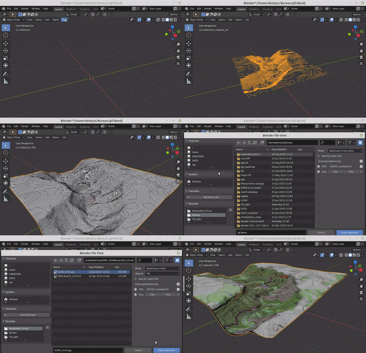
GIS datafile import : Import in Blender most commons GIS data format : Shapefile vector, raster image, geotiff DEM, OpenStreetMap xml.
There are a lot of possibilities to create a 3D terrain from geographic data with BlenderGIS, check the Flowchart to have an overview.
Exemple : import vector contour lines, create faces by triangulation and put a topographic raster texture.
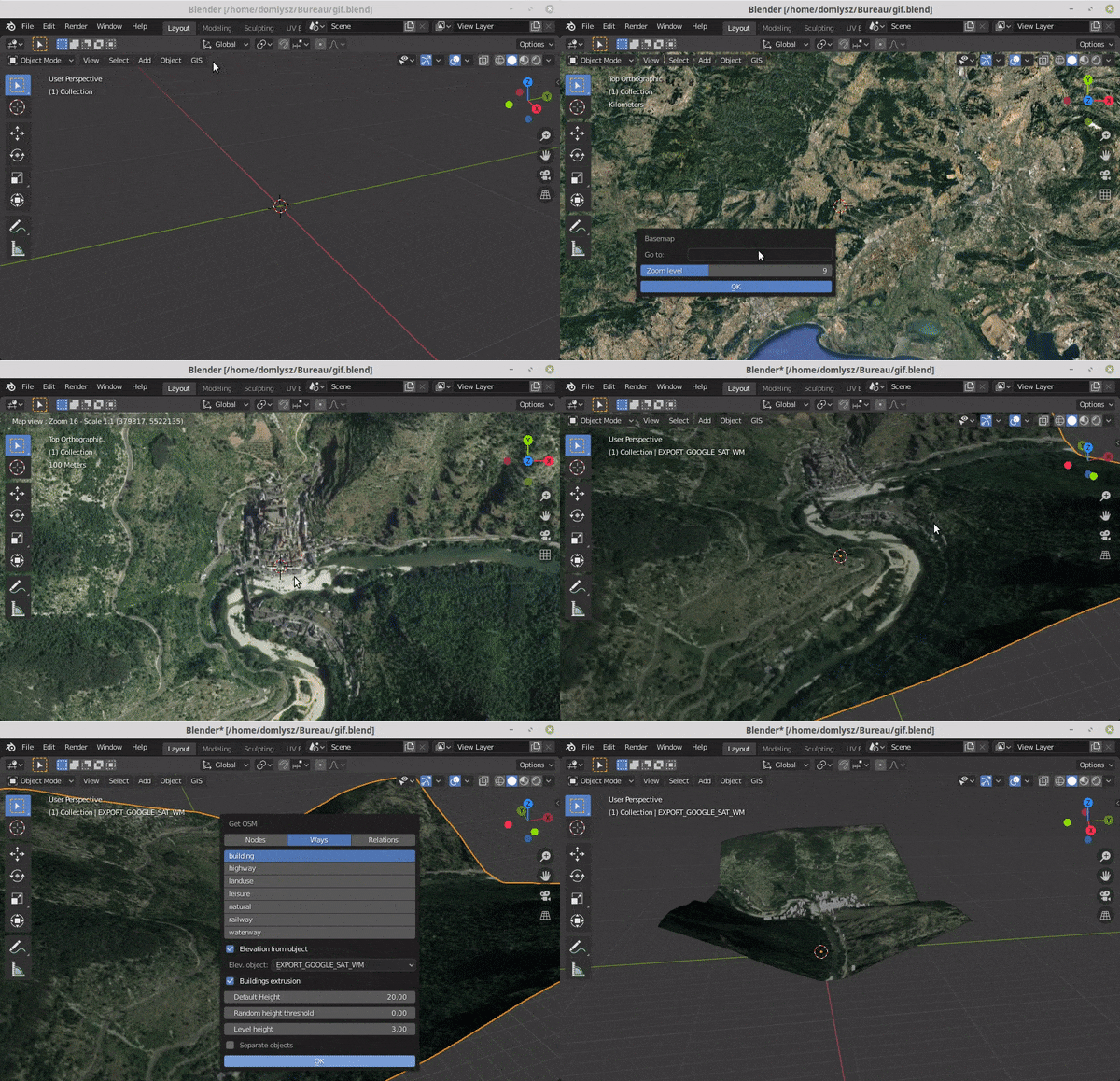
Grab geodata directly from the web : display dynamics web maps inside Blender 3d view, requests for OpenStreetMap data (buildings, roads ...), get true elevation data from the NASA SRTM mission.
And more : Manage georeferencing informations of a scene, compute a terrain mesh by Delaunay triangulation, drop objects on a terrain mesh, make terrain analysis using shader nodes, setup new cameras from geotagged photos, setup a camera to render with Blender a new georeferenced raster.
Explore related projects
ytdl-org/youtube-dl
Command-line program to download videos from YouTube.com and other video sites
141,500 starsexcalidraw/excalidraw
Virtual whiteboard for sketching hand-drawn like diagrams
135,331 starsgodotengine/godot
Godot Engine – Multi-platform 2D and 3D game engine
119,840 starsmrdoob/three.js
JavaScript 3D Library.
117,905 stars