
bresca-ai/TrailReplay
bresca-ai/TrailReplay has 83 GitHub stars and 30 forks. GitHot measured 0 stars in 24 hours. Last checked 2026-11-15 05:22 UTC. Last push 2026-11-13.
What you can do
- Import one or many GPX files and replay them on an interactive 3D map.
- Trim the start and end of a route with a draggable recording timeline, preview it on the map, and download the retained interval as GPX.
- Build a full journey by combining tracks, reordering them, and adding transport segments.
- Display live stats, elevation, pace, and route progress during playback.
Measured star growth
- in 24h
- 0
- in 7 days
- Collecting history
- in 15 days
- Collecting history
- in 1 month
- Collecting history
Net star changes over overlapping periods, not daily totals. Missing measurements are left blank. Stars measure attention, not software quality.
About
Turn GPX routes into animated 3D replays and shareable videos in your browser.
Web & AppsREADME.md
Original

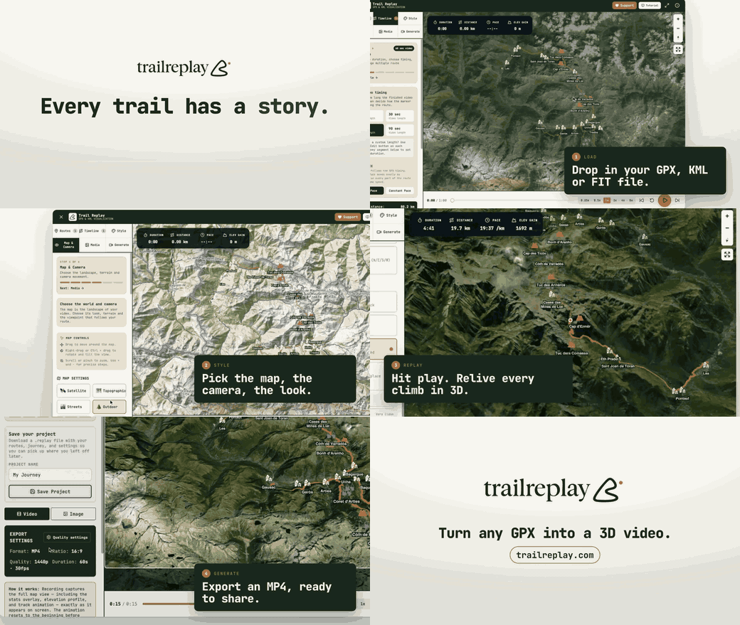



TrailReplay is a browser-based GPX storytelling studio for runners, cyclists, hikers, and outdoor creators. It turns raw route files into polished, shareable replays with map animation, live stats, elevation, media, and export-ready video, all directly in the browser.
The frontend lives in app/.
Why It Exists
Most GPX tools stop at route inspection. TrailReplay is built for presentation: turning an activity, a trip, or a comparison between tracks into something easy to review, explain, and share.
What You Can Do
- Import one or many GPX files and replay them on an interactive 3D map.
- Trim the start and end of a route with a draggable recording timeline, preview it on the map, and download the retained interval as GPX.
- Build a full journey by combining tracks, reordering them, and adding transport segments.
- Display live stats, elevation, pace, and route progress during playback.
- Attach photos to the route from metadata when available or place them manually.
- Add annotations and storytelling moments along the route.
- Compare tracks from the same time window and inspect timing differences.
- Export polished videos with map motion, stats overlays, elevation profile, and branded output.
- Keep the core GPX workflow local in the browser by default.
Demo
See a route brought to life with animated maps, annotations, photos, and live stats.
https://github.com/user-attachments/assets/2191746d-cbd7-43e5-8382-8986a8706931
Core Workflow
- Import GPX tracks.
- Clean up or combine them into a single journey.
- Add photos, annotations, and visual context.
- Replay the route on the map.
- Export a ready-to-share video.
To trim a route, open Routes → Trim route and drag the two handles. The orange interval is retained; green and red markers show its new start and finish. Boundaries snap to recorded points and preserve their timestamps and sensor values. Routes without reliable timestamps use a distance axis. Choose Download GPX to export the selection or Apply to route to update the route and its statistics. Restore original remains available during the current session; saved projects contain only the current route. In this first version, projects containing media, annotations, comparison tracks, camera keyframes or transport segments support preview and GPX download; apply trims before adding those items.
Live Links
- App: trailreplay.com
- Tutorial: trailreplay.com/tutorial.html
- GPX download guide: trailreplay.com/gpx-download-guide.html
Local Development
From the repository root:
npm --prefix app install
npm run dev
From the app folder:
cd app
npm install
npm run dev
Useful commands:
npm run lint
npm run test
npm run build
npm run preview
The root scripts delegate to the active frontend in app/.
Contributing and Releases
TrailReplay's source is public under its attribution license. Please read the contribution guide before opening an issue or pull request, and report security-sensitive issues through the security policy.
TrailReplay deploys its main branch to trailreplay.com through Cloudflare Pages. See the release runbook for the release and deployment workflow.
Stack
- React 19 + TypeScript + Vite for the frontend application.
- MapLibre GL for the interactive map and route playback surfaces.
- Zustand for app state and editor workflows.
- Vitest and Testing Library for test coverage.
- GitHub Discussions for community feedback and feature requests.
Repository Layout
app/: active TrailReplay frontend, help pages, public assets, and testsfunctions/: Cloudflare Pages Functions for the deployed sitedocs/branding-assets/: logo files and brand assets used by the projectdocs/internal/: maintainer-facing implementation notes and issue writeupsmedia/: repository media used in documentation and demosdocs/operations/: contributor-facing release and operational runbooks
Notes
- The active runtime is the browser app inside
app/. - Help, tutorial, and GPX guide pages ship alongside the main app.
- GPX processing stays local in the browser by default; community feedback is posted through GitHub Discussions.